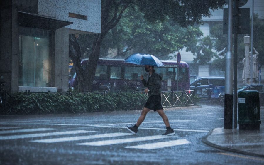
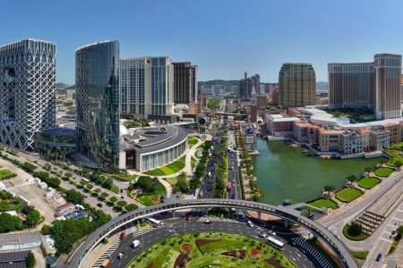
Macao lowered the tropical cyclone signal for Typhoon Wipha from level 8 to level 3 at 10:30 pm today, after raising it all the way to no. 10 in the afternoon.
Under Macao’s typhoon warning system, a no. 10 signal is the highest tropical cyclone level, with sustained wind speeds of up to 118 kilometres per hour, which are accompanied by “gusts of great intensity.” Meanwhile, signal no. 8 – the third highest level – means that winds hit a sustained speed between 63 to 117 kilometres per hour. A lowering to signal no. 3 will bring speeds down to a sustained level of 41 to 62 kilometres per hour.
[See more: Global climate change is behind the rise in severe typhoons]
Wipha had been bringing gale-force winds, heavy showers, and thunderstorms to Macao, causing widespread transport and business disruption
However, as the typhoon edges further from the territory, the signals are being gradually lowered. Despite this the impact of Wipha remains, with Macao’s weather forecaster noting that “there will be strong winds, heavy showers and thunderstorms in Macao tonight and tomorrow.”
According to a dispatch issued tonight by the Metrological and Geophysical Bureau (known by its Portuguese initials SMG), Wipha marks the fifth time that a typhoon signal no. 10 has been issued in Macao since 2017. As well, Wipha represents the earliest instance of a typhoon signal no. 10 being issued since records began in 1968.
What is Typhoon Wipha’s present position and forecast track?
At 10 pm, Typhoon Wipha was estimated to be about 190 kilometres West-southwest of Macao and was forecasted to move west at around 22 kilometres per hour toward western Guangdong.
What about transport in Macao during Typhoon Wipha?
With typhoon signal no. 8 lifted, vehicle access between the Macao peninsula and the Taipa and Coloane districts has resumed, with all four of the city’s cross-sea bridges and the Lotus Bridge reopening. Meanwhile, the lower deck of Sai Van Bridge – designed for traffic use under adverse weather conditions – will gradually cease operation.
Macao’s two major bus operators, Transmac and TCM, as well as the Macao Light Rapid Transit Company have also announced the resumption of their services from 10:30 pm. Special taxi services have also been restarted. Meanwhile, bus services using the Hong Kong-Zhuhai-Macao Bridge have been suspended until further notice. .
With the announcement of typhoon signal no. 3, all scheduled ferry sailings between Macao and Hong Kong from the Outer Harbour and Taipa are expected to resume.
[See more: Macao could be hit by up to 8 typhoons this year, says local forecaster]
Updates on ferry schedules can be obtained from the mobile app Macao Maritime Info. More information about the resumption of TurboJet services is available by sending a query via WhatsApp to (853) 2855 5025. Cotai Water jet says it will post announcements on its website.
All of today’s departing flights at Macau International Airport have either been cancelled or rescheduled. Intending travellers should call the airport hotline on (853) 2886 1111, or their respective airlines, for more details. All arriving flights have been cancelled for today. In total, there have been 140 cancellations and 13 rescheduled flights, the Civil Aviation Authority says.
The Border Gate Checkpoint, the Qingmao Checkpoint, and the Zhuhai-Macao Cross-Border Industrial Zone Checkpoint have reopened. Immigration clearance at Hengqin Port has resumed.
Has Typhoon Wipha caused flooding in Macao?
A blue storm surge warning is currently in force. This means that flooding of up to 0.5 metres above road level may occur in low-lying areas of Macao today and tonight.
When a storm surge warning has been issued, residents are asked to move objects away from areas prone to flooding, and to avoid parking cars in underground car parks. Basements in low-lying districts should not be entered. The power supply system of buildings may be affected by floodwaters and suddenly cut off, meaning that use of lifts should be avoided.
[See more: Three new names have been selected for tropical cyclones in 2025]
Public car parks in low-lying areas have reopened. Residents who need to arrange alternative parking for their vehicles may use, free of charge, the West Car Park of the Hong Kong-Zhuhai-Macau Bridge Macao frontier post until all typhoon signals are cleared.
Are there emergency shelters available?
Yes. Four shelters have been opened for the public: the Ilha Verde Emergency Shelter; the Macao Federation of Trade Unions Workers Stadium; the Taipa and Coloane Social Service Centre (Taipa Branch); and the Academy of the Public Security Forces.
Officials said that as of 10 pm, 139 people had made use of the shelters since its opening.
Has Typhoon Wipha caused any injuries or damage?
As of 9 pm, five people were reported injured, according to officials from the Health Bureau and Kiang Wu Hospital. One case of a person trapped in a lift was reported.
The Civil Protection Operations Centre meanwhile said it had recorded 98cases of “concrete, signboards, windows, canopies, or other objects fallen or swinging” and 54 cases of buildings, lamp posts or trees “that are on the verge of collapse” or “have collapsed.” There was one case of fire, while several trees appear to have been uprooted.
An unauthenticated video being shared on social media in Macao as Wipha raged appeared to show large pieces of stone cladding falling from a tall residential building resembling a block at the upscale Nova Grand residential development. It is unclear if there were any injuries.
Meanwhile, local media reported that two people were fined for walking on the Governor Nobre de Carvalho Bridge during the typhoon in contravention of traffic regulations.
I’m a visitor in Macao. What should I do during Typhoon Wipha?
Remain in your hotel or accommodation until the typhoon has passed. The Macao Government Tourism Office (MGTO) hotline is meanwhile available 24/7 for travel and emergency advice. Call (853) 2833 3000.
How is Typhoon Wipha affecting Hong Kong?
Macao’s neighbouring SAR is located just 60 kilometres away, on the opposite side of the Pearl River Estuary.
The observatory there has lowered the no. 8 signal to a no. 3, which it says will “remain in force for some time.” Once the impact of the typhoon begins to dissipate, the forecaster notes that it will either hoist a signal no. 1 or substitute the current typhoon warning with a strong monsoon signal.
[See more: These are the names suggested by Macao for incoming typhoons]
Nearly 250 people in Hong Kong have taken refuge in government shelters and hundreds of flights have been cancelled. Some 21 people have sought treatment at public hospitals and there have been more than 360 reports of fallen trees.
Where will Typhoon Wipha go after Macao?
Later tonight, Wipha is expected to make landfall somewhere on the coast between Macao’s immediate neighbour Zhuhai and Zhanjiang – a city of 7 million people in southwestern Guangdong province.
Nearly 280,000 people have been evacuated to safe locations in Guangdong. In Zhuhai, transport, work and business has been suspended.
[See more: Climate change could push Macao’s sea levels 64 centimetres higher than they are now]
China’s National Meteorological Centre has issued an orange alert – the second-highest level in the mainland’s warning system, indicating an elevated risk of flooding, substantial property damage, transport disruptions, and threats to safety.
How can I stay updated about Typhoon Wipha?
The Macao government is posting regular civil protection news bulletins here.
Weather dispatches from the SMG are being posted here.
The Hong Kong Observatory is posting weather bulletins on its website and YouTube channel. Most of the videos are in Cantonese but important updates are provided in English as well.


