Calling Macao a city of bridges would not be an overstatement given their importance in linking the various parts of the territory together. But they are a relatively recent development in the city’s centuries-long history.
The first bridge to link Macao and Taipa, the Governor Nobre de Carvalho Bridge, didn’t open until 1974. The second one, the Amizade Bridge, didn’t appear until 20 years later, in 1994. The next three came in relatively quick succession: the Lotus Bridge connecting Cotai and Hengqin (2000); the Sai Van Bridge, linking the peninsula to Taipa once again (2005); and the behemothic Hong Kong-Zhuhai-Macao Bridge (inaugurated in 2018 after nearly a decade of construction).
[See more: The Macao Bridge walk lures 21,000 residents in spite of the heat]
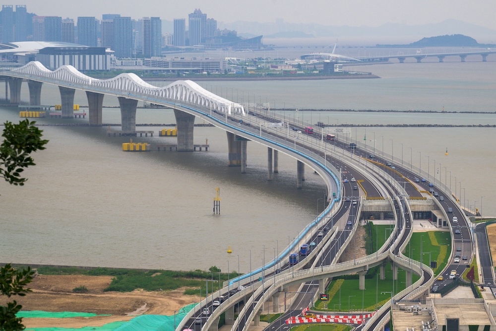
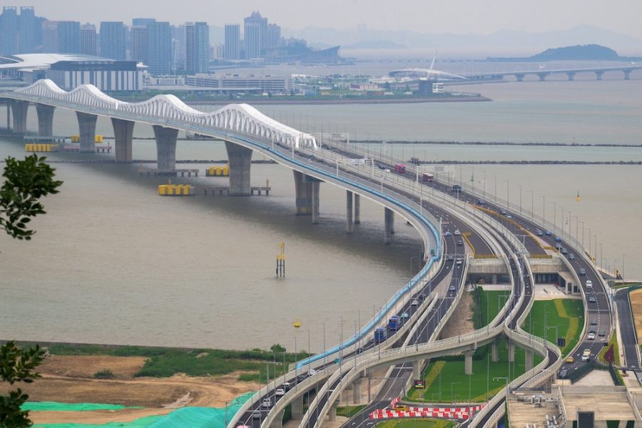
This year, Macao welcomed its fourth Macao-Taipa Bridge: the somewhat pedantically named Macao Bridge, as some would say. It opened to traffic on 1 October. To celebrate the city’s new landmark, here’s a look back at the history of Macao’s six bridges.
Governor Nobre de Carvalho Bridge (1974)
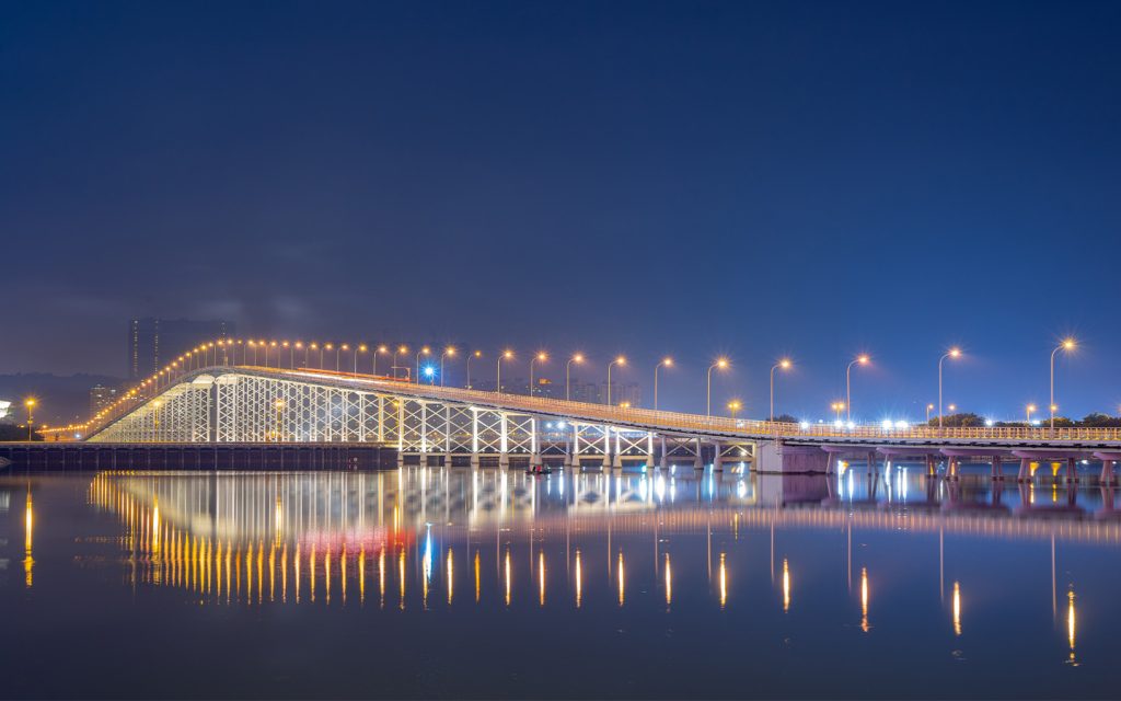
This year marks the 50th anniversary of the Governor Nobre de Carvalho Bridge (嘉樂庇總督大橋).
Macao’s very first bridge opened to traffic on 5 October 1974. Before its construction, travelling between the peninsula, Taipa and Coloane meant a laborious one-hour journey by boat. Hoping to speed up travel across the islands, the then Portuguese Governor of Macao, Jose Manuel de Sousa e Faro Nobre de Carvalho, proposed to Portugal’s Overseas Ministry the idea of building a Macao-Taipa Bridge in January 1969.
The following month, the Portuguese authorities dispatched one of the country’s foremost engineers, Edgar Cardoso, to oversee the construction of the bridge, which would end up linking the area near the peninsula’s Hotel Lisboa with the north of Taipa.
Work on the 14.8-million-pataca project began on 18 June 1970 and wrapped up four years later. The end result was a two lane bridge, with a length of 2.57 kilometres, a width of 9.2 metres and two narrow pedestrian footpaths on either side measuring just 0.8 metres across.
At the time of its opening, it was the longest continuous prestressed concrete girder bridge in the world. Although the bridge is no longer the engineering marvel it once was, it remains an important part of Macao, as exemplified by its inclusion in the SAR’s regional flag and emblem, which feature an abstract rendition of its distinctive bell-shaped curve.
When the Governor Nobre de Carvalho Bridge first opened, vehicles crossing it had to pay a toll. This was scrapped in 1982 due to the overwhelming volume of traffic. Since 2007, only public buses, taxis and other specially designated vehicles such as ambulances have been allowed access on the bridge. The structure also holds the distinction of being the only bridge in Macao to allow for the passage of pedestrians, but walking along its narrow footpaths in heavy traffic isn’t exactly a pleasant experience.
Trivia: Officially, the bridge takes its namesake from the governor who conceived it, although it has adopted a number of other monikers, including the Macao-Taipa Bridge (澳凼大橋), the old bridge (舊橋), the middle bridge and the Cantonese name “Heong Gai Kiu” (香雞橋), a humorous reference to the crossing’s pillars, which are said to resemble leftover stubs of burnt joss sticks.
Amizade Bridge (1994)
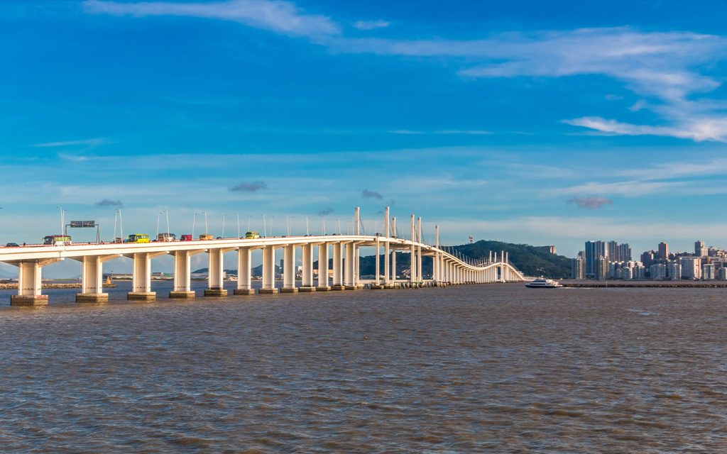
Plans to build the Amizade Bridge (友誼大橋) or Friendship Bridge, as it is known in English, began on 8 October 1988, after the Portuguese administration deemed it necessary to develop a second Macao-Taipa bridge to meet the city’s rapid development and growing number of vehicles.
Construction of the 373-million-pataca structure began on 18 August 1990, with engineer Câncio Martins in charge of its design. It officially opened on 17 April 1994, although a bridge walk involving 20,000 residents was staged the day before.
[See more: Government vows to ensure Friendship Bridge safety]
Of the Macao-Taipa bridges, the four-lane Amizade Bridge is by far the longest, measuring roughly 4.4 kilometres. The crossing, which connects the peninsula’s Areia Preta district to the Pac On area in Taipa, is also 15 metres wide and features a name that references the friendship between China and Portugal.
Unfortunately, the bridge has a reputation for being something of an accident blackspot. For instance, just last month, 9 motorists were injured after four cars collided while travelling on the bridge. In an earlier incident that same month, a motorcyclist found themselves trapped under a tour bus. The crossing’s lack of a designated motorcycle lane could be the culprit, as it causes many motorcyclists to treat the bridge’s narrow 1.5-metre-wide emergency lane as a motorcycle lane, even though it increases their risk of being swiped by passing cars.
Lotus Bridge (2000)
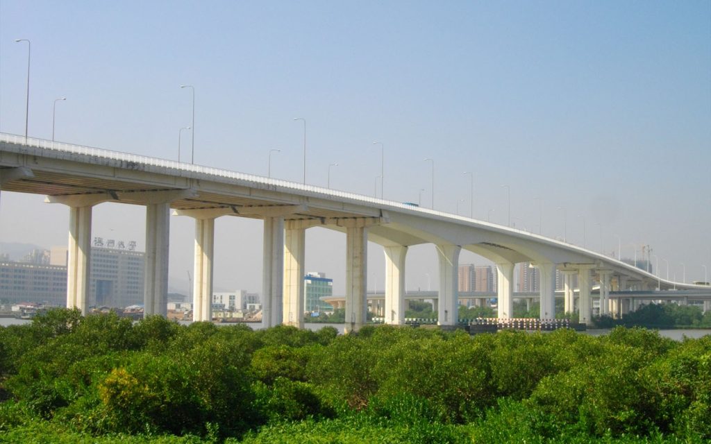
The Lotus Bridge (蓮花大橋) plays an important role in facilitating Macao’s integration with the Chinese mainland, linking the Cotai area with Hengqin.
Construction of the six-lane crossing, which is 1.67 kilometres long and 30 metres wide, began on 29 June 1998, with the 200 million yuan cost being shared between the mainland and Macao government. On 28 March 2000, the bridge opened to traffic, helping to alleviate pressure on the transportation of goods via the Border Gate.
[See more: Construction of the LRT’s Hengqin extension has finished]
The name of the bridge is a reference to Macao’s municipal flower, while the bridge’s distinctive curved ramps are shaped to look like two large 9s, a reference to the handover of Macao’s sovereignty to China in 1999. In an aerial view, the curves also resemble the petals of a lotus leaf. Even better: their shape allows for vehicles travelling between Macao and mainland China to seamlessly switch to and from left and right-handed driving.
Sai Van Bridge (2004)
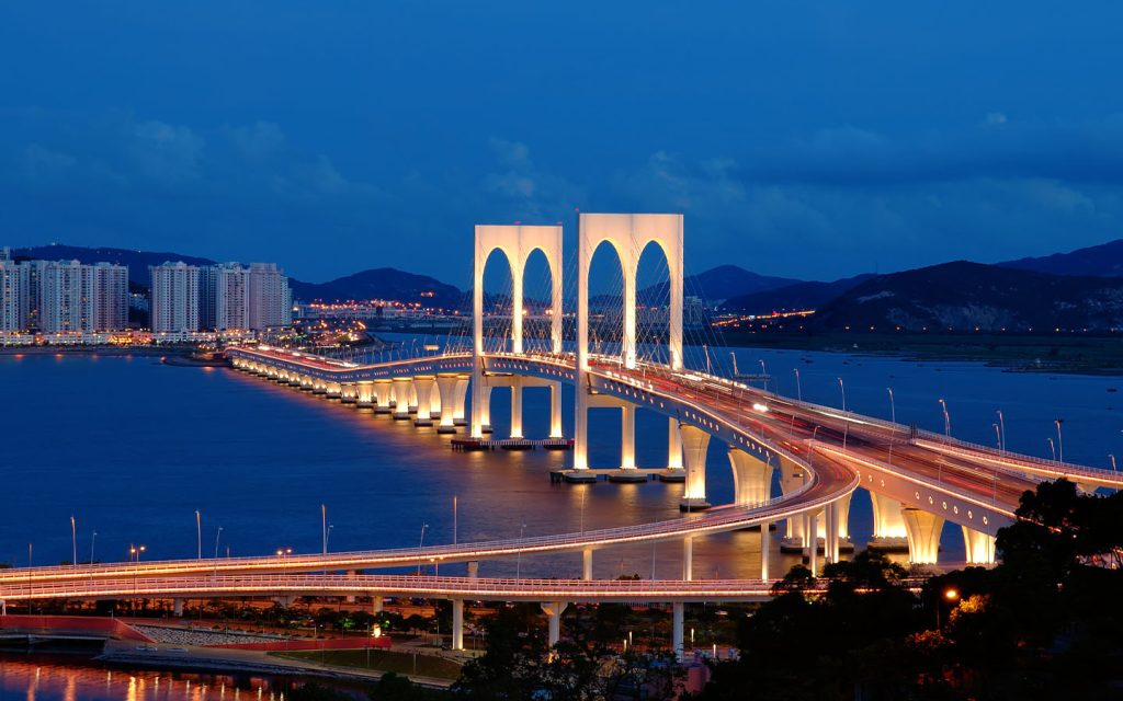
Like the Amizade Bridge, the Sai Wan Bridge (西灣大橋) was built to alleviate traffic. During his inaugural policy address in 2000, then-Chief Executive Edmund Ho Hau Wah raised the possibility of a third Macao-Taipa bridge, noting that it was necessary to “improve traffic in the city.”
Work on the 560-million-pataca structure – which links the peninsula’s Sai Van area with Taipa’s Ocean Garden – commenced in October 2002. A competition was held to come up with names for the bridge, with Hou Kong Bridge (濠江大橋), Hou Keang Bridge (濠鏡大橋) and A-Ma Bridge (媽閣大橋) among the contenders.
The name “Sai Van Bridge” ultimately came out on top. An inauguration ceremony attended by Chinese President Hu Jintao was held on 9 December 2004. The 6-lane bridge then opened to vehicular traffic on 9 January, although 50,000 residents had the opportunity to take part in a bridge walk the day before.
[See more: The Taipa-Barra LRT extension has opened]
When the crossing first opened, both cars and motorcycles were permitted to ride alongside each other. In 2012, the authorities added designated motorcycle lanes, which were made permanent in 2016.
Lengthwise, the Sai Van Bridge is the shortest of all the four Macao-Taipa bridges, measuring only 2.2 kilometres. It also sets itself apart from Macao’s other crossings with its double-deck design, although the enclosed lower deck is only open to cars during typhoons. With the opening of the Barra light rail station, the bottom deck is also being used to ferry train passengers between the peninsula and Taipa.
The bridge’s two 85-metre arches are also an important element of its design, with the Public Works Bureau stating that are intended to resemble the letter “M” in Macao, as well as the Roman numeral III – a reference to its status as the city’s third bridge.
Hong Kong-Zhuhai-Macao Bridge (2018)
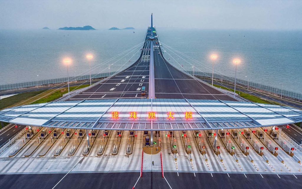
OK, this is not a local bridge as such. As its name implies, the Hong Kong-Zhuhai-Macao Bridge (the HZMB for short and 港珠澳大橋 in Chinese) is shared between three jurisdictions. Nonetheless, its massive presence is hard to miss in Macao and it has revolutionised the city’s road connections to the surrounding region.
An ambitious project in every sense of the word, HZMB spans a length of 55 kilometres and is the world’s longest sea crossing as well as one of the ten longest bridges in the world. For perspective, the HZMB is 20 times as long as the Golden Gate Bridge in San Francisco and has 420,000 tonnes of steel – enough to build the Eiffel Tower 60 times.
Although construction of the HZMB kicked off on 15 December 2009, the idea of building a bridge that allows for speedy travel from Hong Kong to Macao in 30 minutes, and Zhuhai in 45 minutes, can be traced all the way back to 1983 and a Hong Kong businessman named Gordon Wu. As the chairman of the property firm Hopewell Holdings, Wu had lobbied for the building of the bridge for decades, telling the South China Morning Post in 2002 that it would elevate Hong Kong’s position as the key port in the region.
[See more: Zhuhai sets a new bridge record]
He had his wish granted when the HZMB opened on 24 October 2018. Gone were the days of having to take a 70-minute ferry ride from Macao to Hong Kong. Suddenly the neighbouring SAR was a mere 40-minute drive away.
For a project of this scale, there were obviously immense challenges. For starters, the bridge’s jaw dropping cost (51.5 billion yuan) had to be divided between the central government, the governments of Guangdong, Hong Kong, Macao and a coalition of Chinese banks. Logistically, the HZMB was a nightmare, as it involved the building of numerous components, including a 22.9-kilometre-long elevated bridge, a 6.7-kilometre underwater tunnel and four artificial islands.
The end result speaks for itself, although it was not without its human toll – the deaths of 18 workers, as well the injury of dozens more.
Macao Bridge (2024)
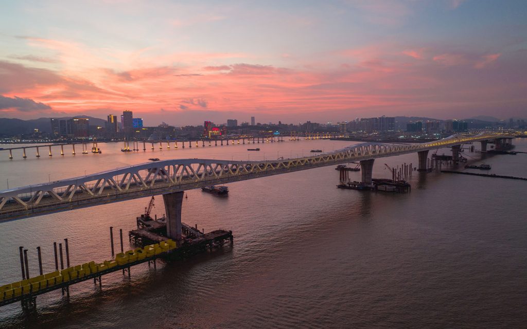
The city’s latest bridge, the Macao Bridge (澳門大橋), began to take shape in 2010, when the SAR government began studying a proposal to build another crossing to connect the as yet unnamed artificial islands that are currently referred to as Urban Zone A with Urban Zone E1.
As with the Amizade and Sai Van bridges, the construction of the fourth bridge was a response to Macao’s rapid development and the need for additional infrastructure to cope with the increased traffic between Macao and Taipa.
Work on the 8-lane bridge – which is 2.9 kilometres long and 280 metres wide – began in March 2020 and concluded in June 2024. Like the Sai Van Bridge, two of the lanes are designated for motorcycles.
[See more: The Macao Bridge officially opens to traffic]
One area that sets the Macao Bridge apart is the presence of wind protection barriers that should allow for vehicles to safely drive on the bridge during a signal 8 typhoon. The government, however, is still looking to collect real-life data in actual storm conditions before giving the final go ahead.
The building of the bridge was largely free from controversy, although construction had to be delayed several times as a result of the Covid-19 pandemic, as well as the death of a construction worker who fell from a height of 30 metres this April.
One area of the Macao Bridge that has been the subject of persistent ridicule is its prosaic name, which some local social media users consider to be lacking in originality. We’ll let you be the judge: other shortlisted names included New Urban Bridge (新區大橋), Silver Jubilee Bridge (銀禧大橋), Kiang Hoi Bridge (鏡海大橋) and Hou Kong Bridge (濠江大橋).
