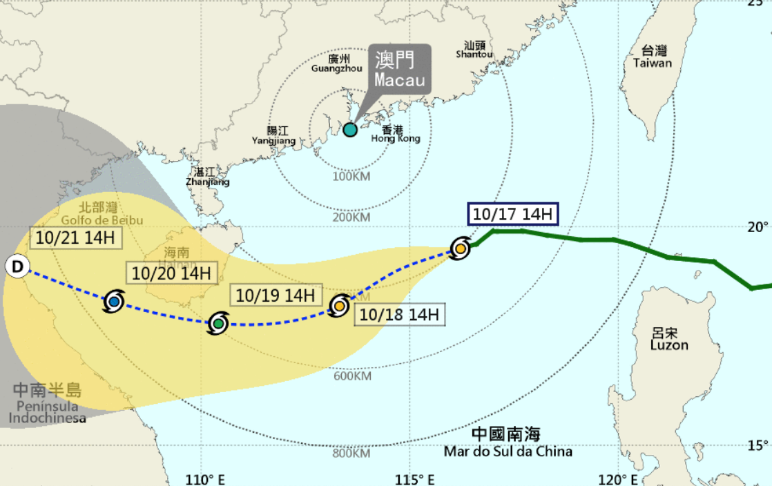
Tropical Cyclone Signal No 1 has been replaced by Signal No 3 and it will remain in effect before midnight, according to the Meteorological and Geophysical Bureau (SMG).
The weather bureau issued Typhoon Signal no 1 at 2 pm yesterday, while the current signal was hoisted at 4:30 pm. As of 4 pm today, Typhoon Nesat was located about 400 kilometres southeast of Macao, moving towards the coast of Vietnam.
The probability of issuing a Blue Storm Surge warning today and Signal No 8 tomorrow remains “relatively low”, the bureau pointed out
As the winds over the bridges are expected to be strong and gusty, drivers are advised to pay attention to traffic safety and motorcyclists should travel between the Macao Peninsula and Taipa through the motorcycle lane on Sai Van Bridge.
Meanwhile, under the joint impact of Nesat and a northeastern monsoon, the local wind will continue to strengthen. The northeastern monsoon will further intensify and move southward tonight, with the tropical cyclone to be close to Macao between today and tomorrow morning, according to the SMG.
The bureau also said the cloud cover will increase from tomorrow to Wednesday, with a few showery patches, while the local temperature will gradually fall, with the minimum temperature predicted to be 17 degrees Celsius on Wednesday.
Despite the chance of Nesat directly affecting Macao being low, slight flooding is possible in the southern Inner Harbour area.


