Macao’s Meteorological and Geophysical Bureau (SMG) hoisted storm-warning Signal No. 3 at 1 pm today.
The weather station said that it expected Signal No. 3 to remain hoisted tonight. However, it added that the likelihood of raising Signal No. 8 was “low”. It had issued standby Signal No. 1 at 7 pm yesterday.
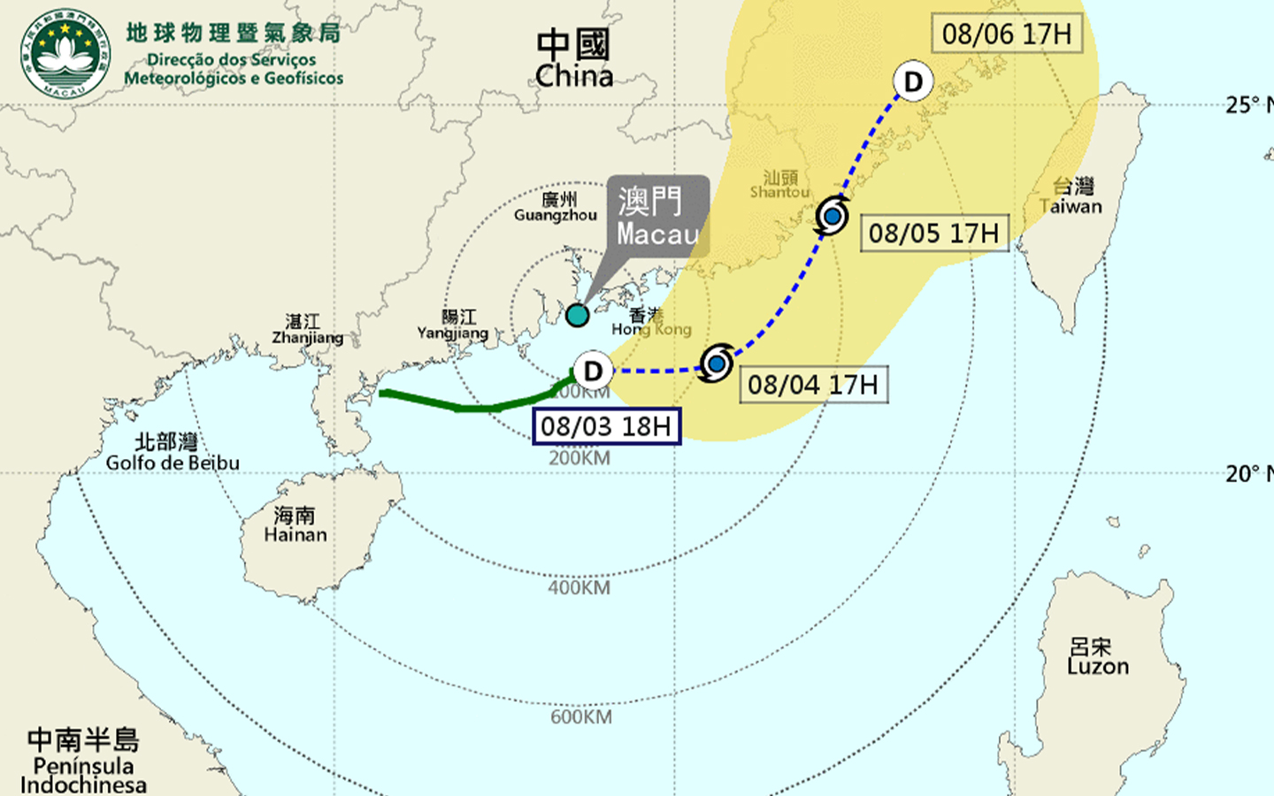
“The tropical depression south of the Pearl River Estuary continues to intensify, and its movement has been slow in the past few hours,” an SMG spokesman said.
“It is forecast that the tropical depression will stay within a 150-km radius of Macao in the next 12 hours, and it will generally move towards the eastern coast of Guangdong.
“Affected by the tropical depression, there will be occasional heavy showers and thunderstorms in Macao, with winds occasionally reaching Level 6 with gusts. Therefore, the Tropical Cyclone Warning Signal No. 3 will remain in effect tonight, and the probability of issuing higher signals is low. The public are advised to pay close attention to the change in weather and the latest news about the storm.
“On the other hand, the possibility of flooding caused by a storm surge is low since the astronomical tide level is low these days. However, the public should still pay attention to the possibility of flooding caused by heavy rains.”
At 5 pm, the tropical depression was located about 90 km south-southeast of Macao.


