


If you’re a hiking enthusiast in tiny Macao, it’s easy to exhaust the local options – or perhaps that should be “option,” singular, since the 8.1 kilometre Coloane trail is the only proper nature walk the SAR can offer. The others, like the Taipa Grade Trail (4 kilometres) and the Coloane Family Trail (2 kilometres) are more like relaxed strolls than actual hikes.
[See more: Hiking in Macao? Follow these 3 trails to experience another side of the city]
But don’t worry. A multitude of hiking options exist within reasonable journey times of the city – whether in Hengqin, Hong Kong, or other parts of the Greater Bay Area. Here are some worth checking out, of varying degrees of difficulty. Check the weather, plan your route, prepare your hiking gear and have fun.
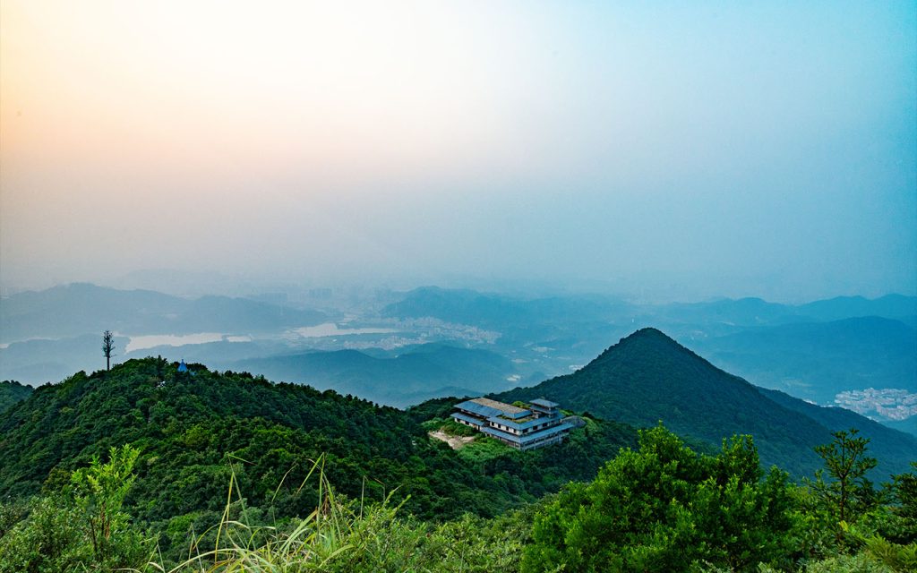
1. Xiaohengqin Mountain Trail, Hengqin
Want to stay close to home? Xiaohengqin Mountain, located on the north side of Hengqin Island, offers around 15 kilometres of hiking trails, with four access points, covering most of the mountain.
The paths aren’t very difficult and are suitable for beginners. Depending on where you pick up the trail, the mountain can be summited in as little as 30 minutes. At the top, you can enjoy beautiful views of both Macao and Hengqin.
How to get there from Macao:
Take the LRT to Hengqin Station, then go through the checkpoint to enter Hengqin. There is no bus service to the Xiaohengqin Mountain Trail, so take a local taxi or use a ride-hailing service like Didi – it’ll get you there in under 20 minutes.
2. Phoenix Mountain, Zhuhai
Phoenix Mountain is located in the northern part of the Xiangzhou District in Zhuhai, with an elevation of 437 meters. The forest coverage on Phoenix Mountain – a national park – reaches 90 percent, making it a lovely green excursion and one of Zhuhai’s most famous hiking spots. Look out for its three ancient paths, which were historical routes connecting Guangzhou and Macao, now restored as safe walking trails.
How to get there from Macao:
The most popular starting point is Meiliwan (“Beautiful Bay”). Hikers can cross into Zhuhai via Macao’s Qingmao Port, then walk about 5 minutes to Zhuhai Railway Station to catch the 32 bus. Get off at the final stop, Shenqian Terminal – the ride takes about an hour – then walk another three minutes to reach Meiliwan.
If you choose to take a Didi ride-hailing service instead, the journey will take approximately 30 minutes.
3. Baiyun Mountain, Guangzhou
If you’re a lazy hiker, this one’s for you. In fact, you don’t even need to walk up the mountain: you could always take a cable car or sightseeing bus (the cable car costs 20 to 25 yuan; the sightseeing bus costs 10 to 20 yuan and you’ll also need to pay 5 yuan for the entrance ticket to Baiyun Mountain.
[See more: Zhuhai has dozens of islands. It’s time you started exploring them]
Or you can challenge yourself by hiking to the main peak, Moxing Summit, which stands at 382 meters above sea level. The hike takes around six hours. Once at the top, you’ll be rewarded with a panoramic view of the entire city of Guangzhou. After rainfall or during the spring season, the mountain is often shrouded in misty white clouds – which is where it gets its name, as Baiyun in Chinese means “white clouds.”
How to get there from Macao:
You can cross the border into Zhuhai via Qingmao Port, then take the high-speed train from Zhuhai Station to Guangzhou South Station (a one-hour journey). From there, take Metro Line 2 to Jiangtai Road Station, transfer to Line 11, and get off at Yuntai Garden Station. After that, it’s a 15-minute walk to the South Gate of Baiyun Mountain.
4. Wutong Mountain, Shenzhen
Wutong Mountain is located in the eastern part of Shenzhen, spanning the Luohu and Yantian districts. It is classified as a national scenic area and national forest park, and it is the highest mountain in Shenzhen, reaching an elevation of 943 meters, just slightly lower than Hong Kong’s highest mountain, Tai Mo Shan.
Wutong Mountain offers several hiking routes of varying difficulty, with the route starting from Xiutong Road being the most popular and taking about two hours to reach the summit. Along the way, there are multiple viewing platforms where hikers can take in panoramic views of Shenzhen and – at least on clear days – even catch a glimpse of Hong Kong in the distance.
How to get there from Macao:
From Zhuhai High-Speed Railway Station, take the train to Shenzhen North Station (a journey of about two hours). Then transfer to Metro Line 5 and ride to Huangbeiling Station. From there, switch to Line 2 and get off at Shenwai Senior High School Station, which is near Xiutong Road.
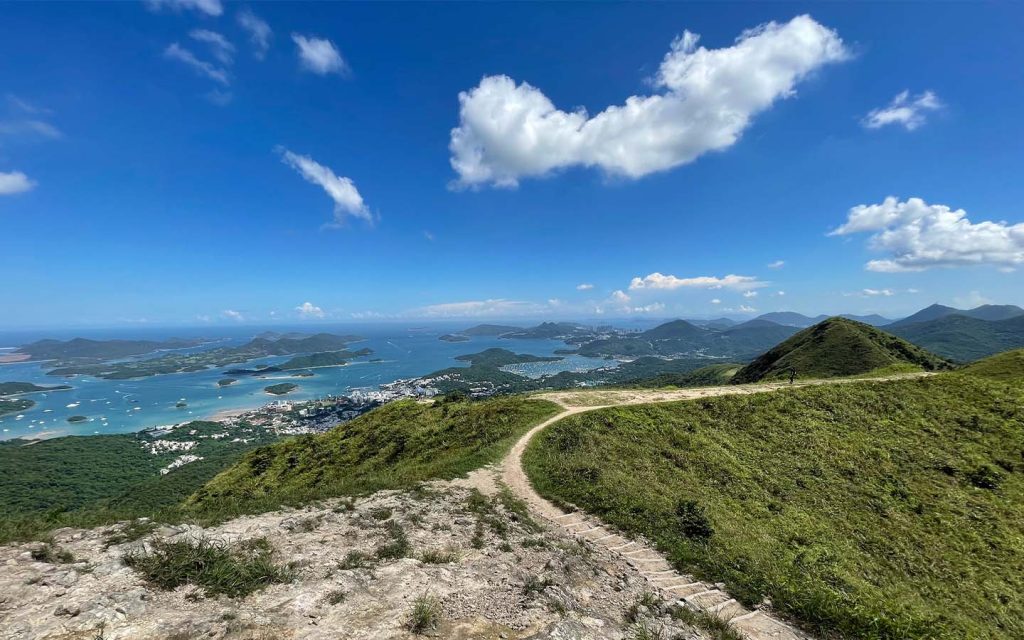
5. MacLehose Trail, Hong Kong
Want to challenge your limits? The MacLehose Trail is a must-visit. As Hong Kong’s main long-distance hiking network, the MacLehose Trail is approximately 100 km long and divided into ten sections. The route generally runs from the eastern Sai Kung peninsula to the western district of Tuen Mun.
[See more: Hong Kong has been ranked the world’s 10th most walkable city]
The difficulty and time required for each of the ten hiking sections vary, ranging from the shortest at four kilometers (two hours) to the longest at 15.5 kilometers (five hours). If you aim to complete the entire MacLehose Trail in one go, you’ll need to pack and tet ad food – it will take five to seven days.
How to get there from Macao:
Take a ferry from Macao to the Hong Kong–Macau Ferry Terminal in Sheung Wan. From there, take the MTR Island Line to Admiralty Station. Transfer to the Kwun Tong Line and ride to Choi Hung Station. Then take bus Route 94 toward Sai Kung and get off at the Pak Tam Chung stop. This is the starting point of the MacLehose Trail.


